
Uploads by Admin
This special page shows all uploaded files.
| Date | Name | Thumbnail | Size | Description | Versions |
|---|---|---|---|---|---|
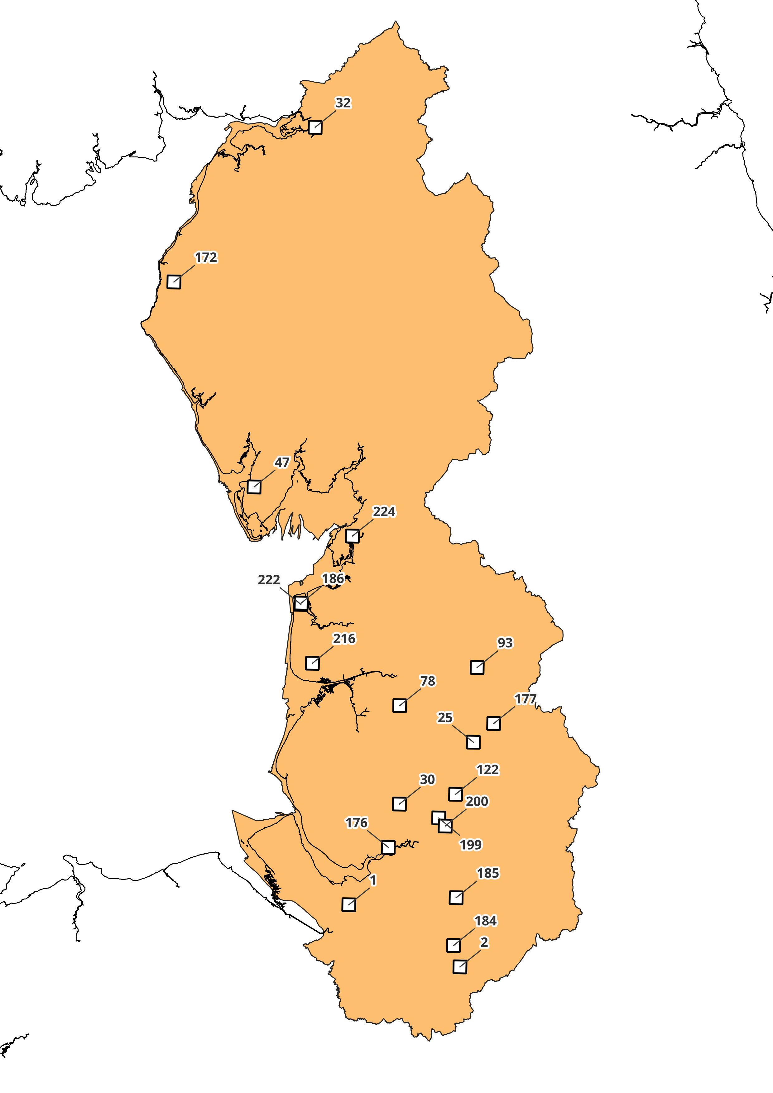
| 09:37, 11 April 2022 | Lf map scotland nonhaz.png (file) |  |
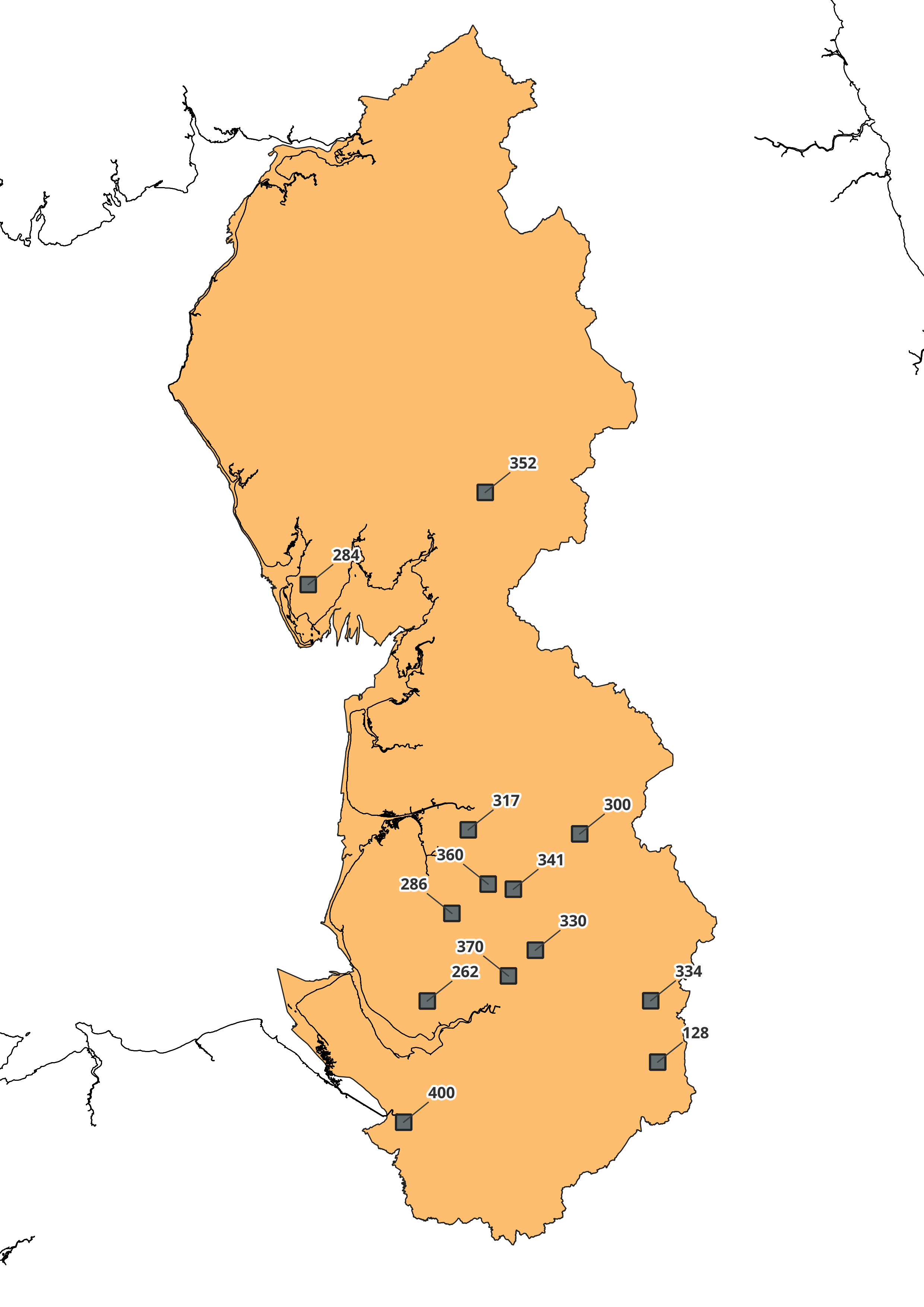
835 KB | Non-Hazardous Landfill in Scotland | 1 |
| 09:34, 11 April 2022 | Lf map nwest nonhaz.png (file) |  |
515 KB | Non-Hazardous Landfill in the North West | 1 |
| 09:33, 11 April 2022 | Lf map neast nonhaz.png (file) |  |
311 KB | Non-Hazardous Landfill in the North East | 1 |
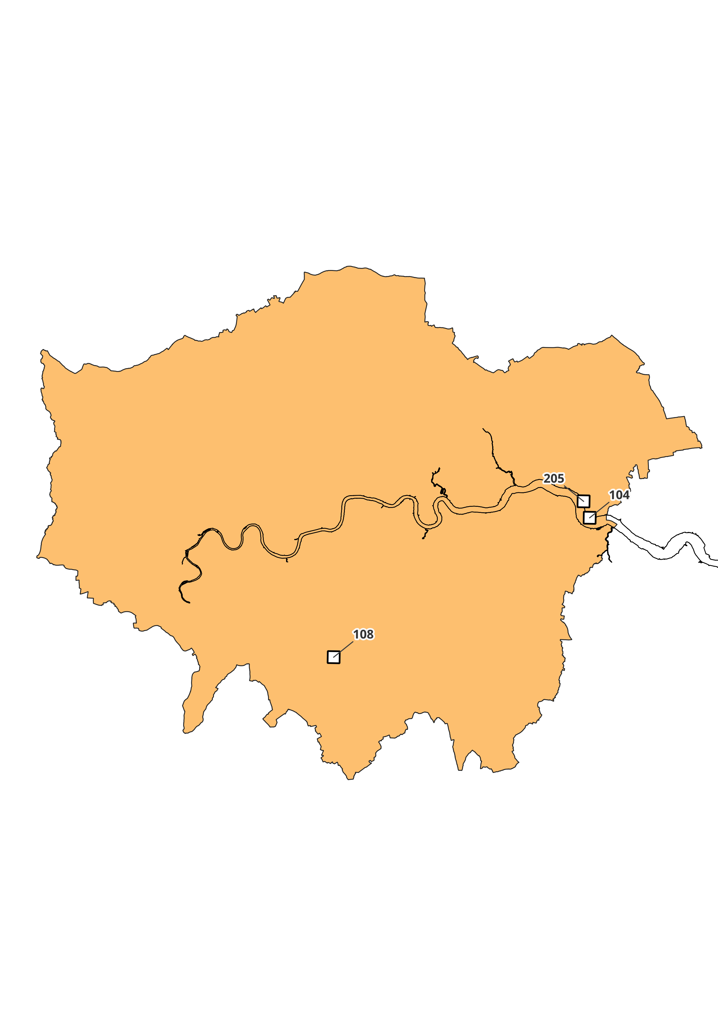
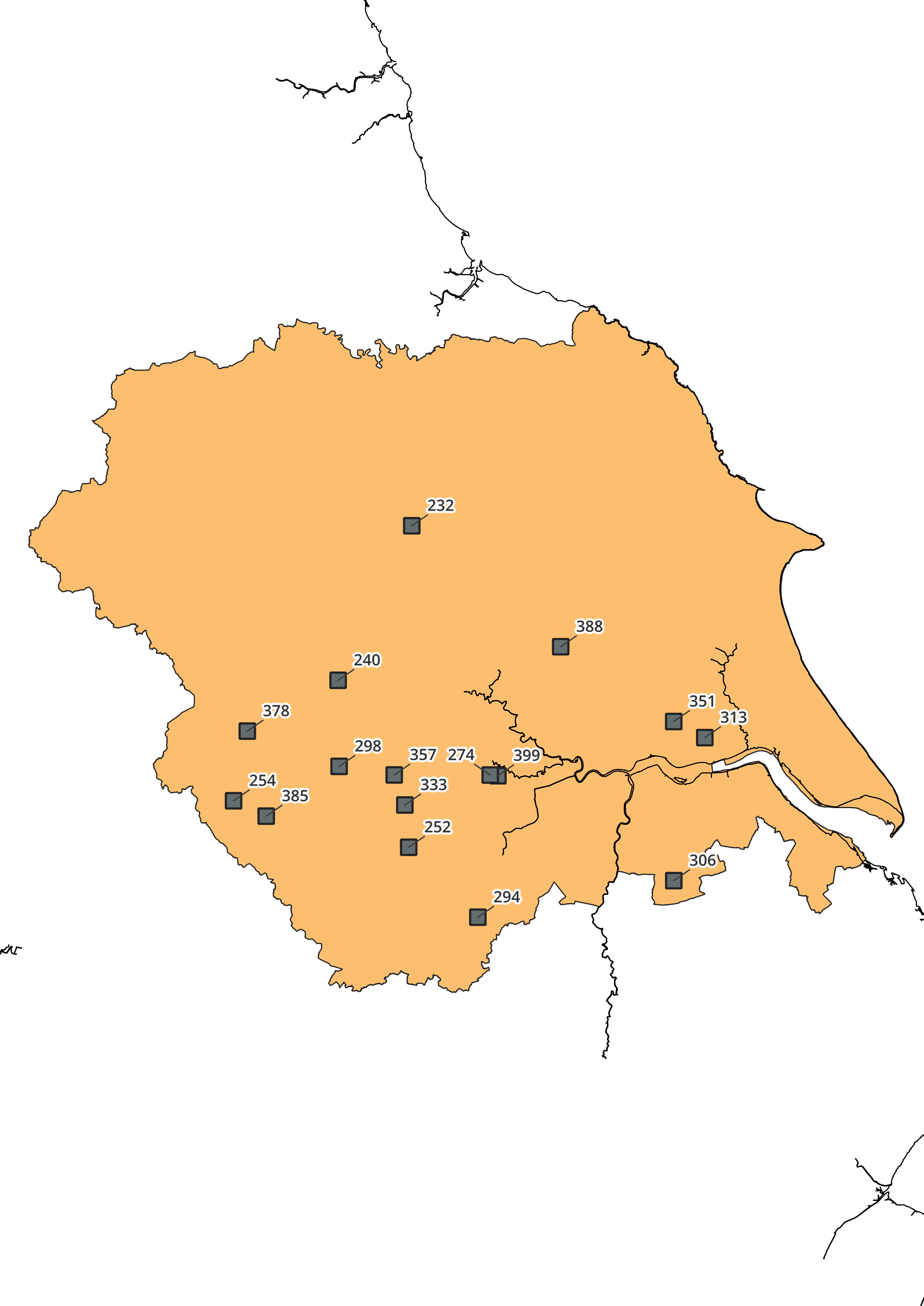
| 09:07, 11 April 2022 | Lf map london nonhaz.png (file) |  |
275 KB | Non-Hazardous Landfill in London | 1 |
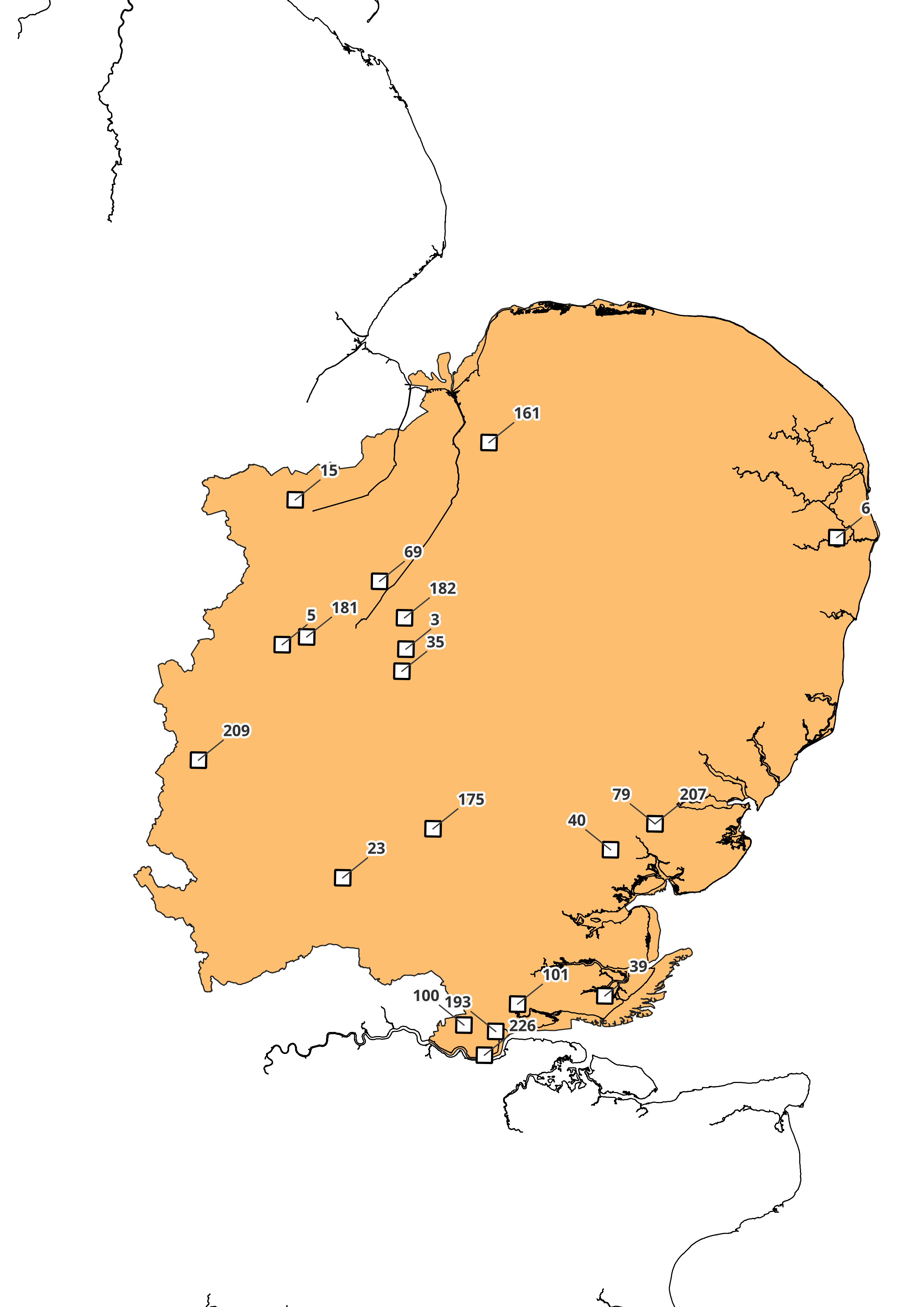
| 09:06, 11 April 2022 | Lf map emids nonhaz.png (file) |  |
444 KB | Non-Hazardous Landfill in the East Midlands | 1 |
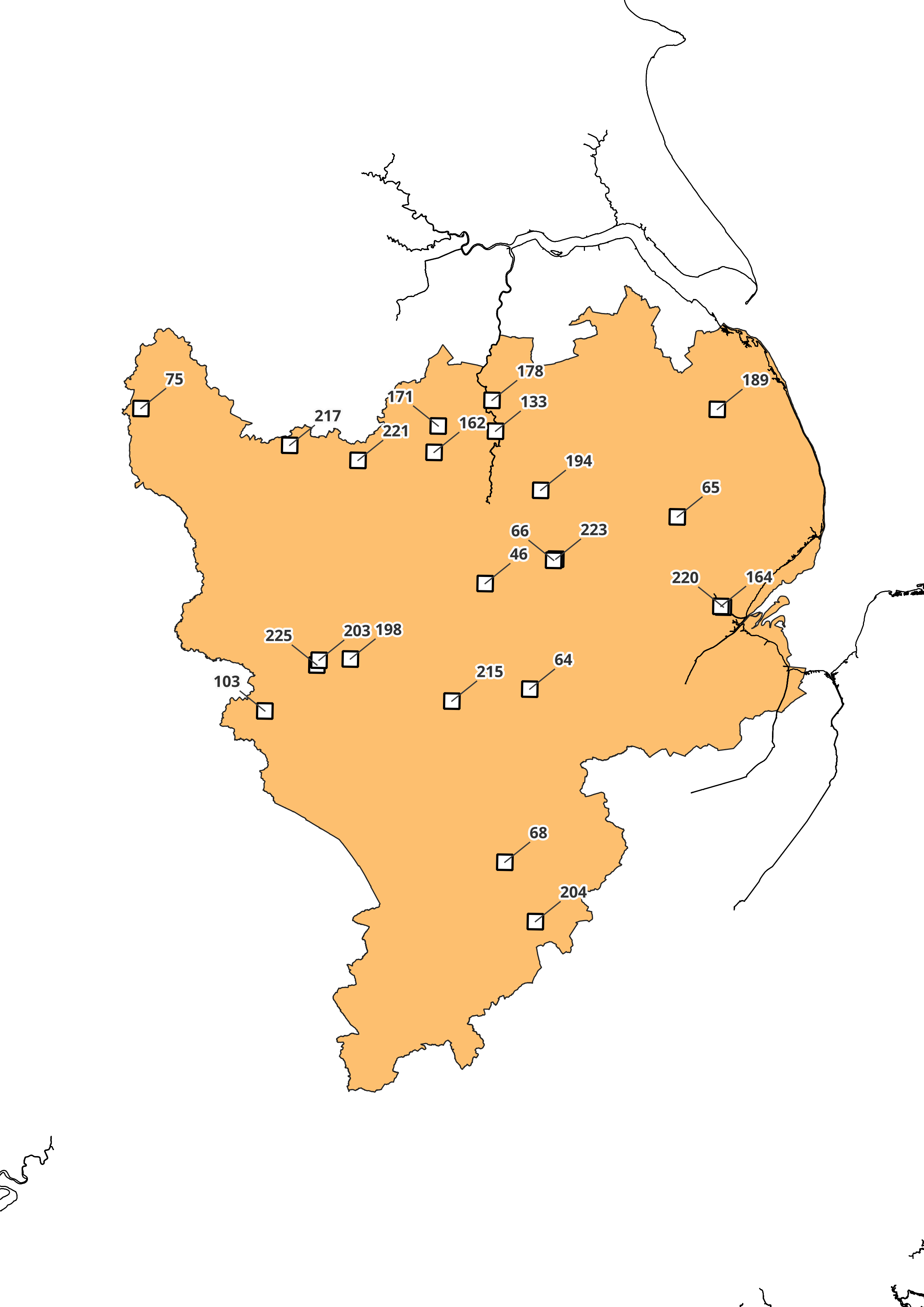
| 09:05, 11 April 2022 | Lf map eengl nonhaz.png (file) |  |
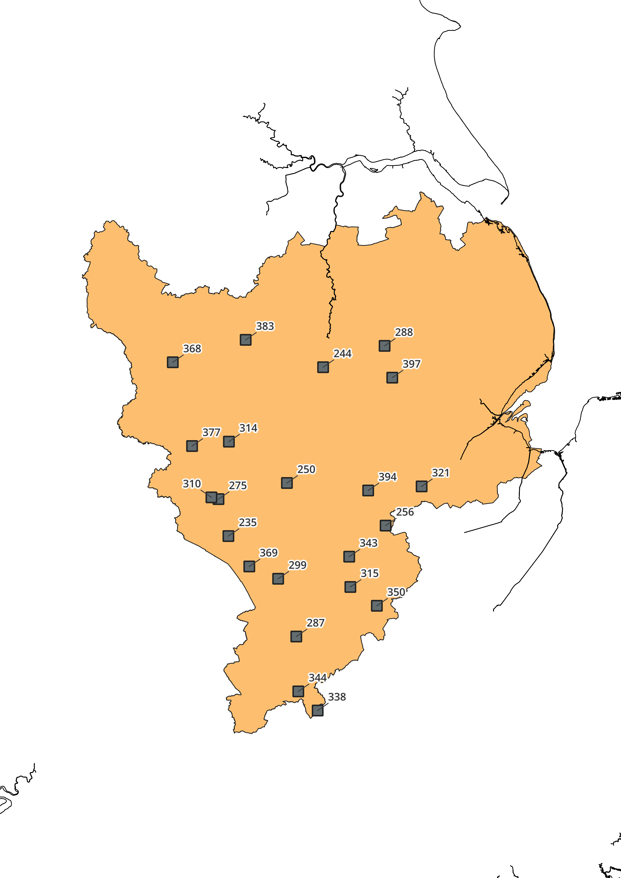
507 KB | Non-Hazardous Landfill in the East of England | 1 |
| 08:02, 11 April 2022 | Lf map yorkhumb inert.png (file) |  |
396 KB | Inert Landfill in Yorkshire and Humber | 1 |
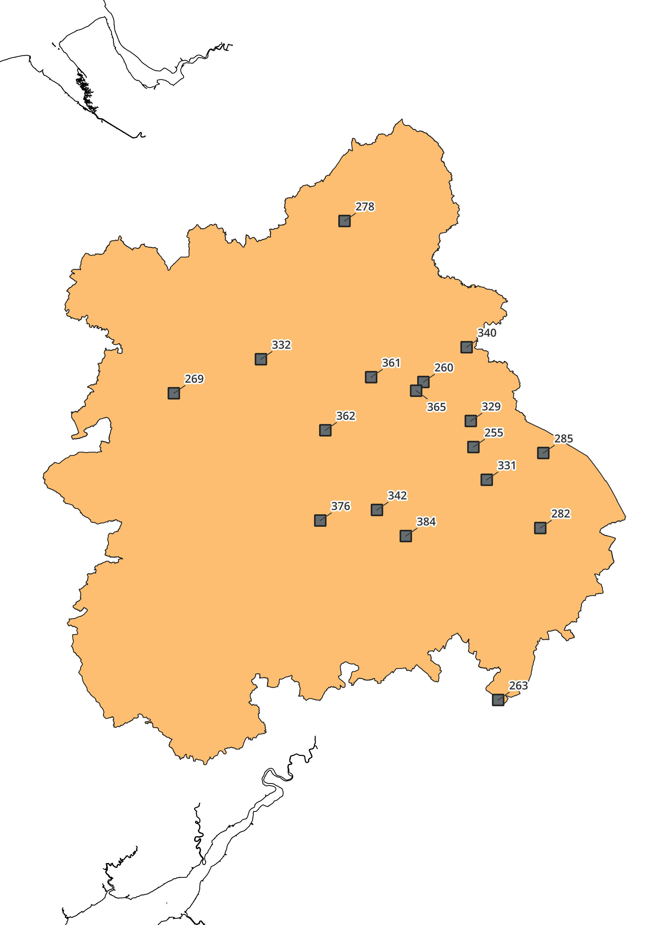
| 07:59, 11 April 2022 | Lf map wmids inert.png (file) |  |
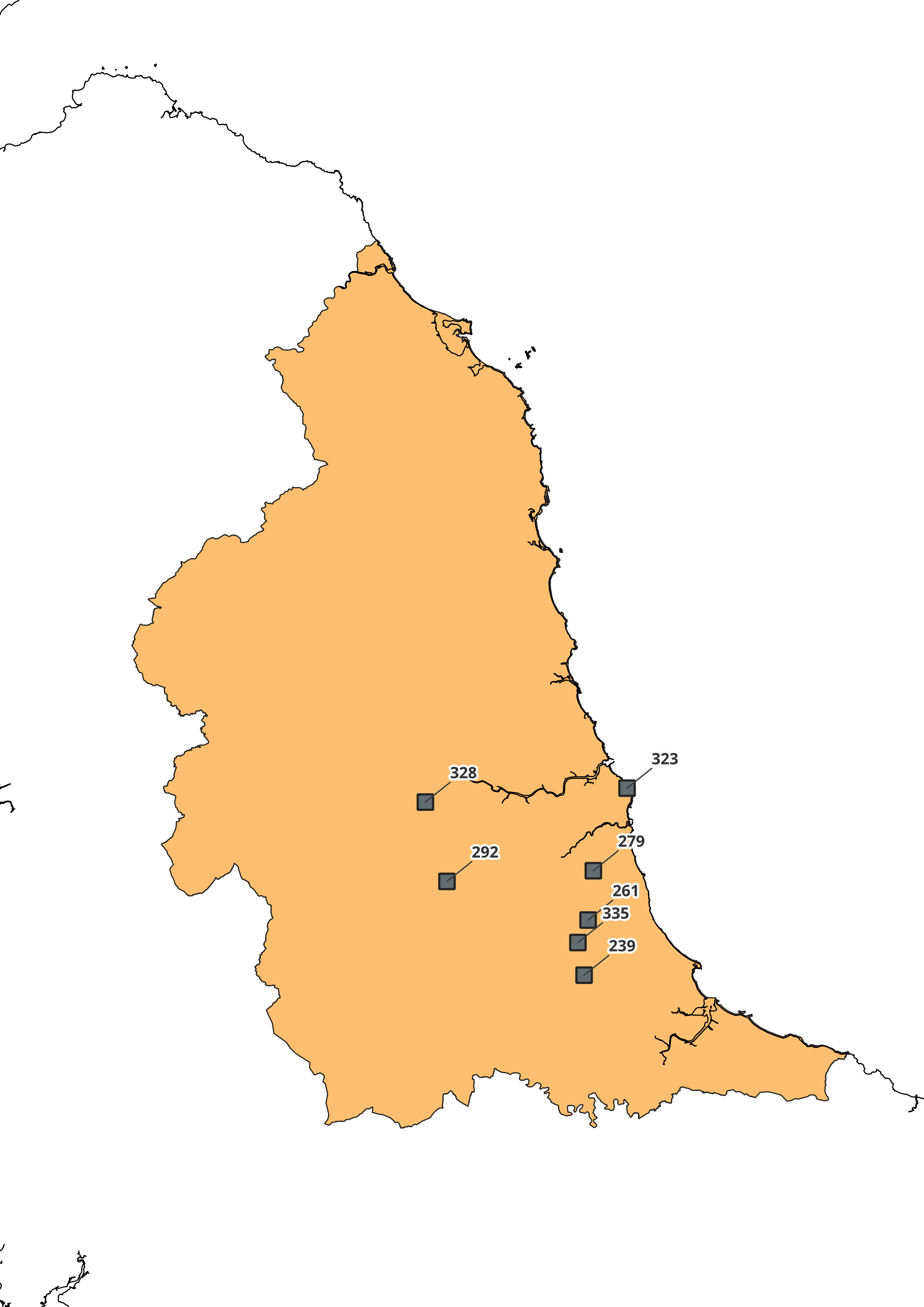
400 KB | Inert Landfill in the West Midlands | 1 |
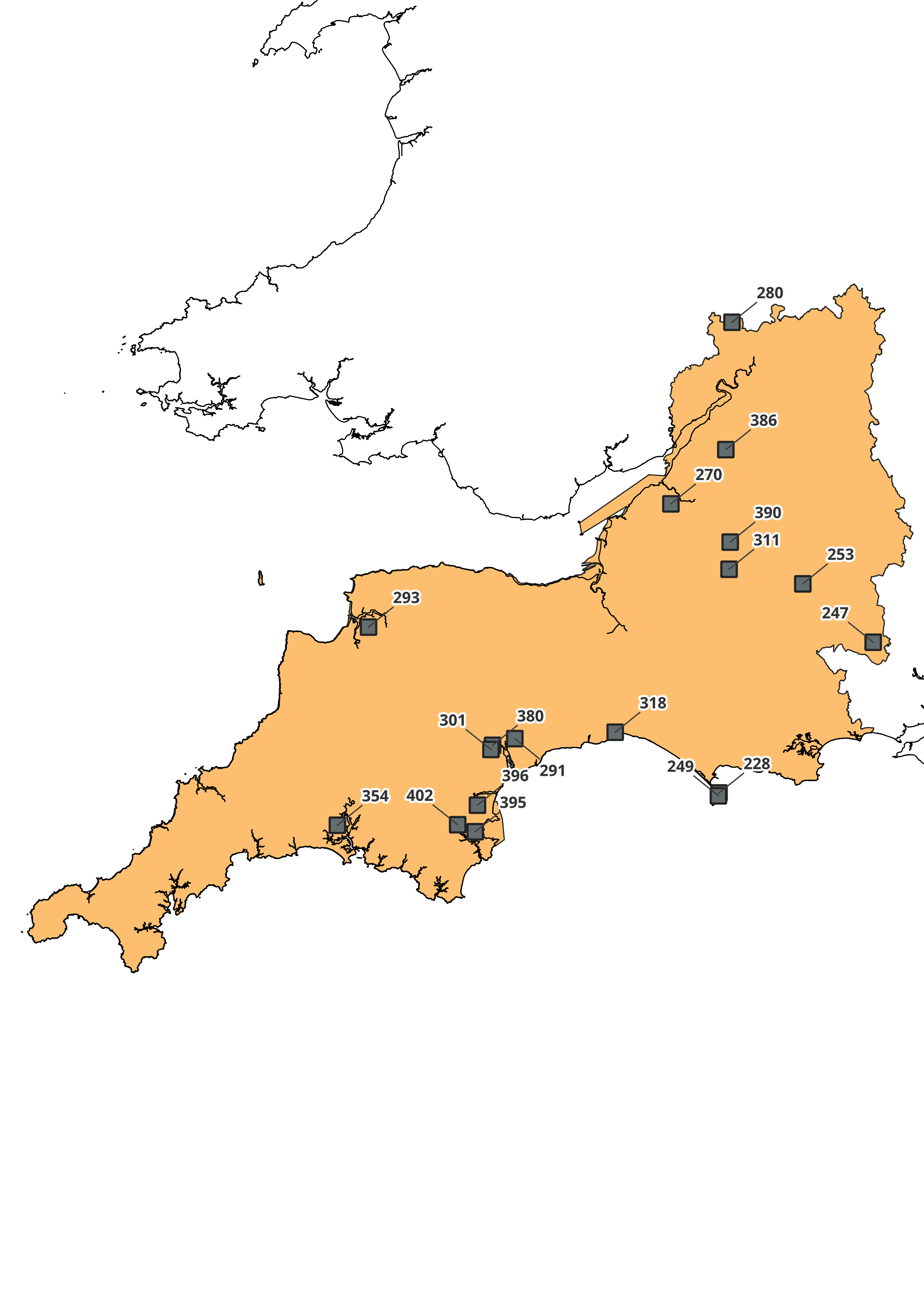
| 07:58, 11 April 2022 | Lf map swest inert.png (file) |  |
434 KB | Inert Landfill in the South West | 1 |
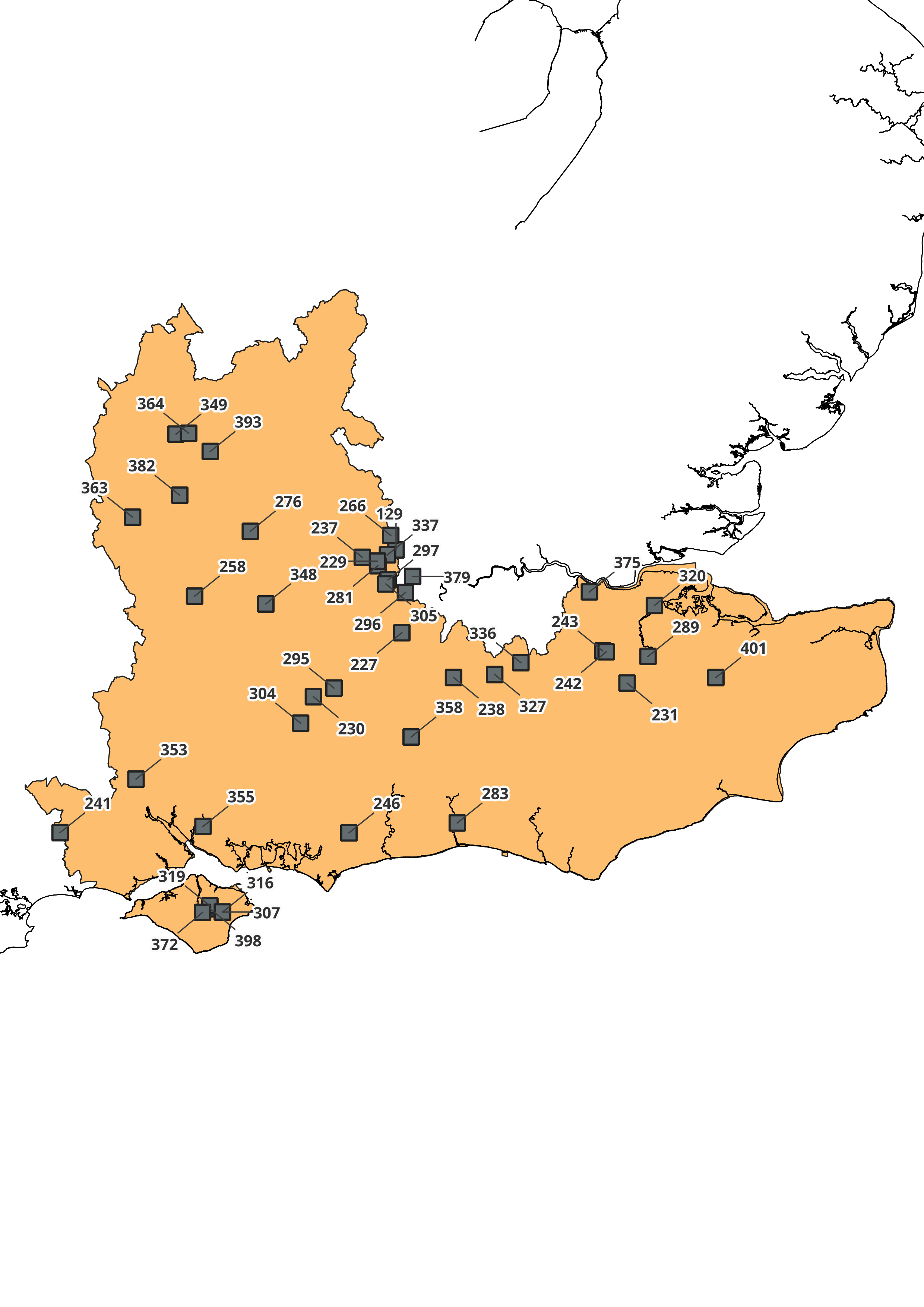
| 07:41, 11 April 2022 | Lf map seast inert.png (file) |  |
587 KB | Inert Landfill in the South East | 1 |
| 07:30, 11 April 2022 | Lf map nwest inert.png (file) |  |
483 KB | Inert Landfill in the North West | 1 |
| 07:29, 11 April 2022 | Lf map neast inert.png (file) |  |
308 KB | Inert Landfill in the North East | 1 |
| 07:27, 11 April 2022 | Lf map london inert.png (file) |  |
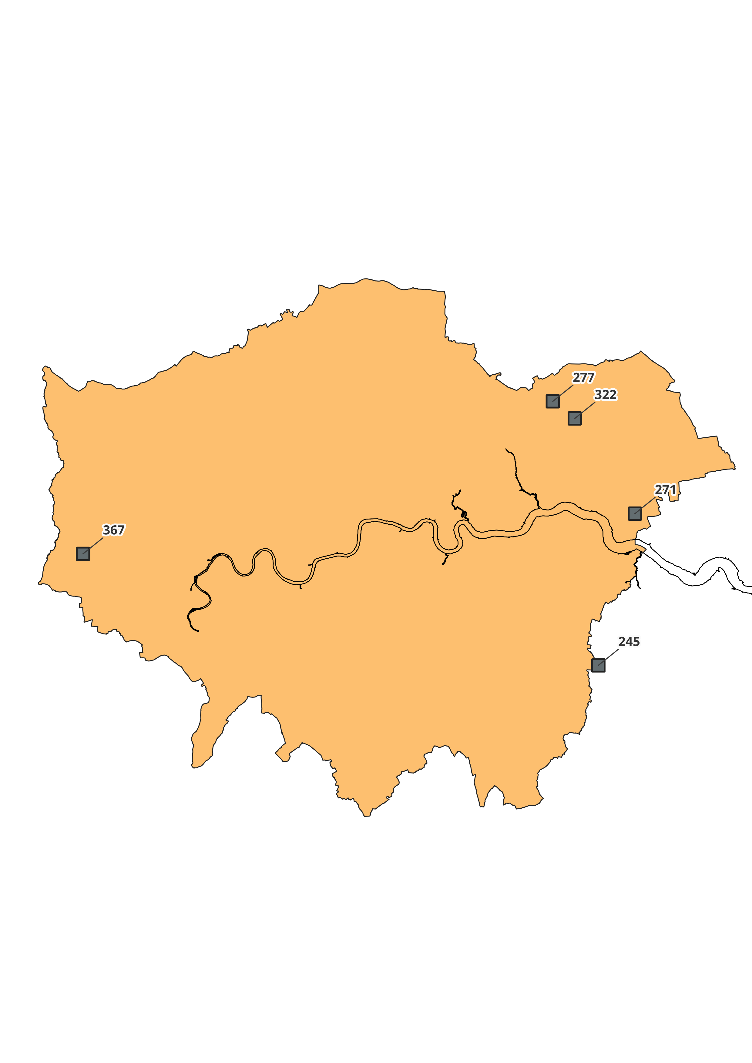
282 KB | Inert Landfill in London | 1 |
| 07:26, 11 April 2022 | Lf map emids inert.png (file) |  |
431 KB | Inert Landfill in the East Midlands | 1 |
| 07:25, 11 April 2022 | Lf map eengl inert.png (file) |  |
600 KB | Inert Landfill in the East of England | 1 |
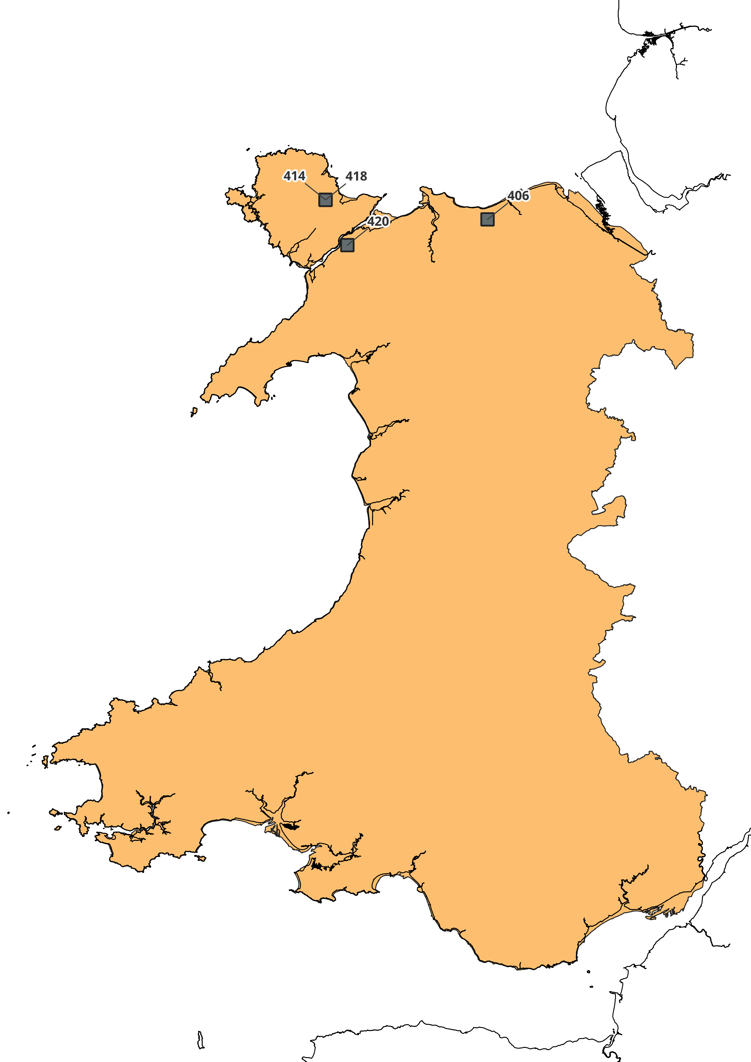
| 13:37, 7 April 2022 | LF map wales inert.png (file) |  |
469 KB | 1 | |
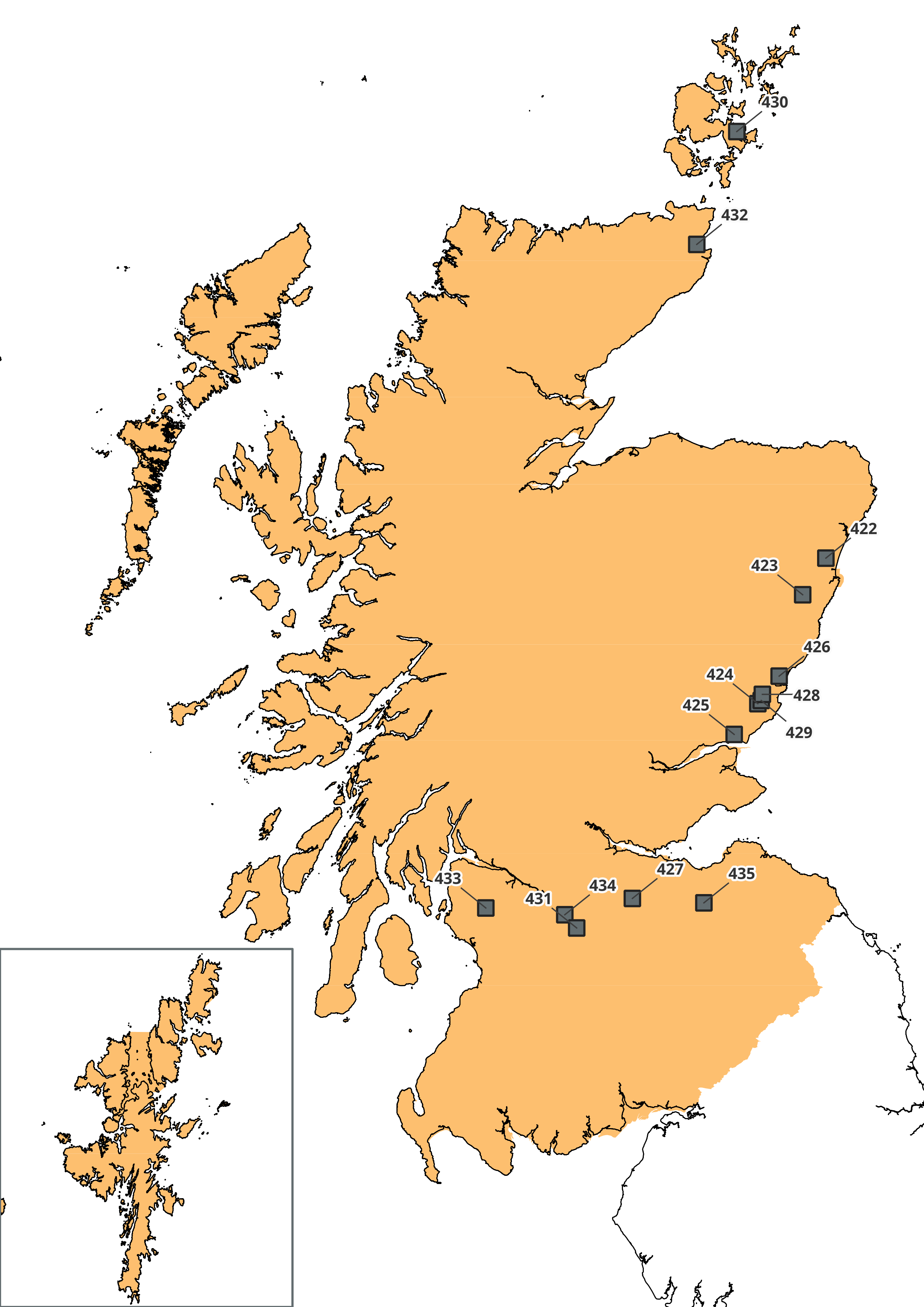
| 13:31, 7 April 2022 | LF map scotland inert.png (file) |  |
767 KB | 1 | |
| 12:22, 5 April 2022 | LF map snrhw.png (file) |  |
886 KB | 1 | |
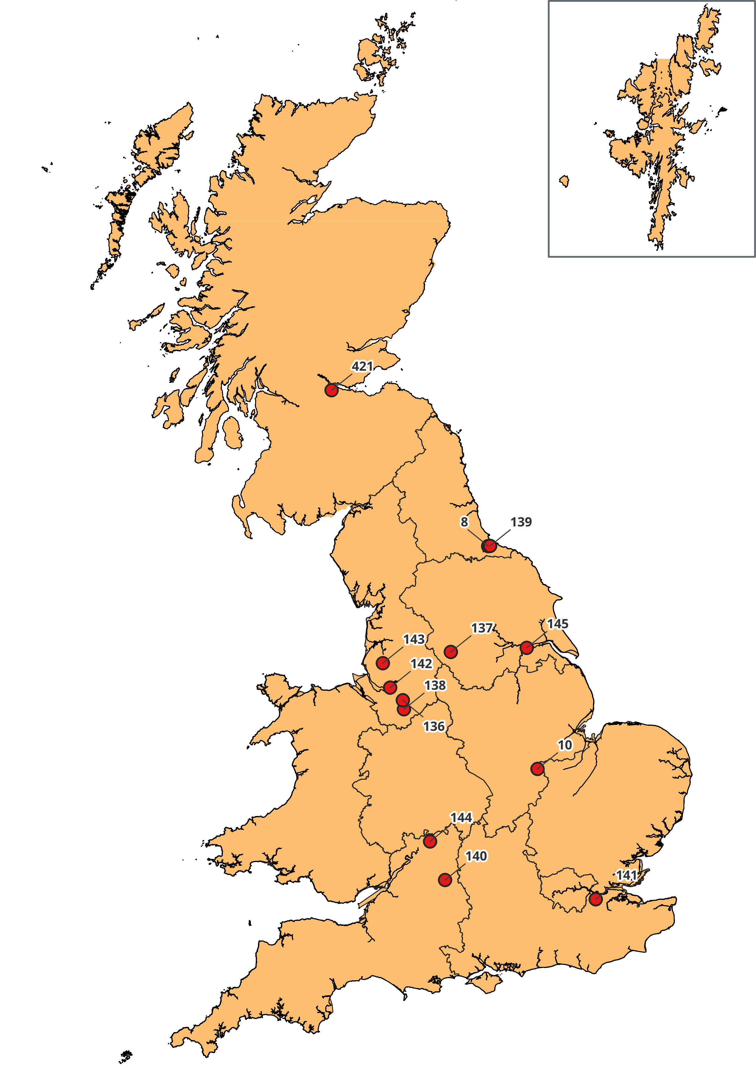
| 12:05, 5 April 2022 | LF map haz.png (file) |  |
764 KB | 1 | |
| 17:05, 24 February 2022 | Monksleigh60px.jpg (file) | 22 KB | 1 | ||
| 11:43, 26 November 2020 | CoGen Logo.png (file) | 28 KB | 1 | ||
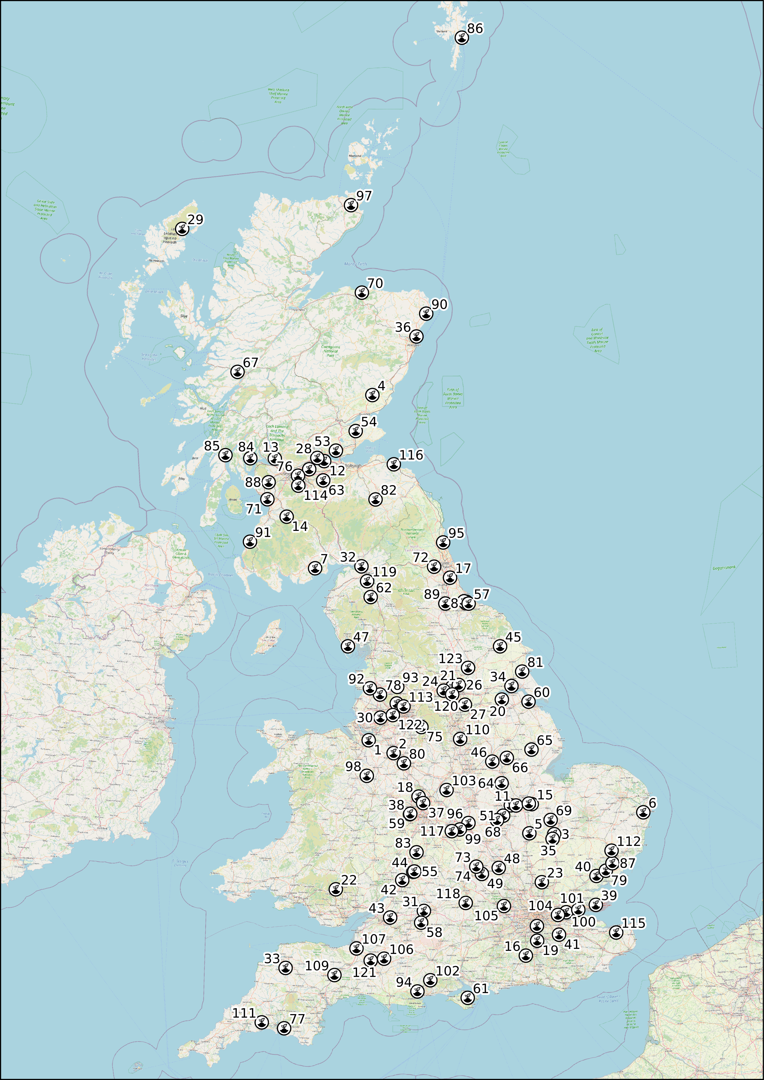
| 09:20, 24 May 2020 | Landlfill map.png (file) |  |
5.86 MB | Updated the icons | 2 |
| 13:41, 28 April 2020 | Cementkilns.png (file) |  |
6.12 MB | Updated colours | 4 |
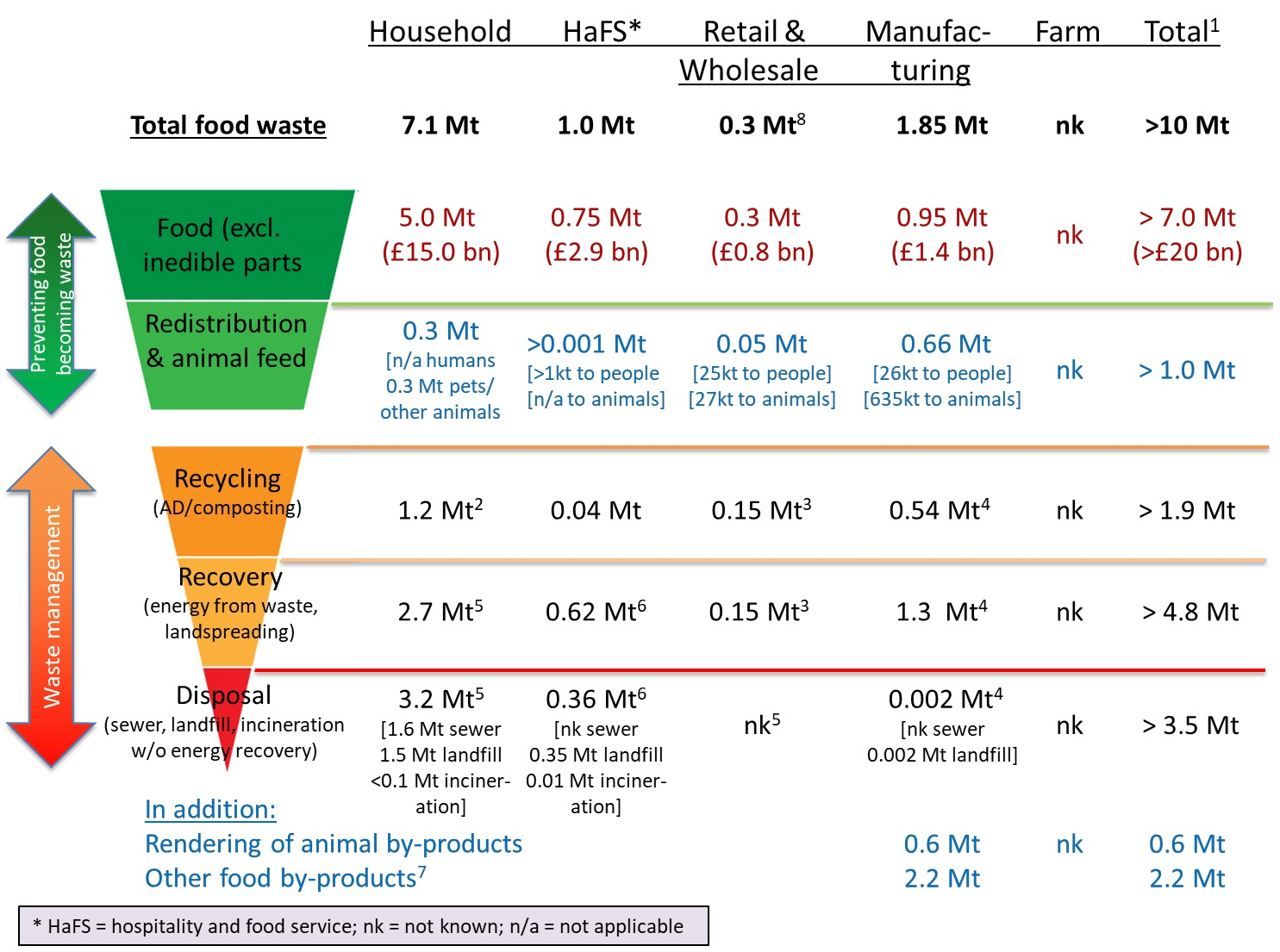
| 13:28, 11 December 2019 | WRAP key facts on food waste diagram.png (file) |  |
680 KB | Updated to large resolution image | 2 |
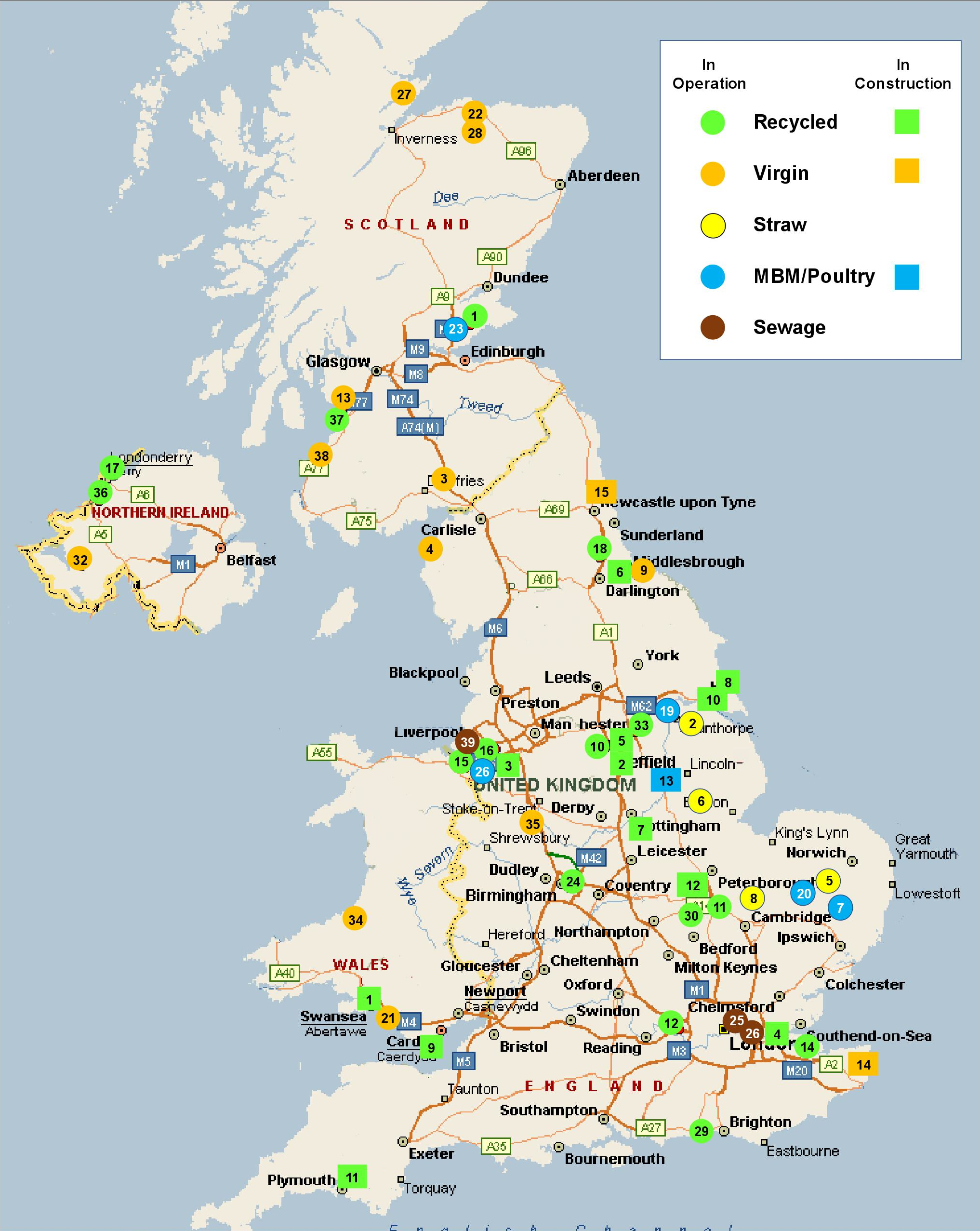
| 10:39, 22 November 2019 | Tolvik Biomass Map.jpg (file) |  |
2.11 MB | 1 |